About NanoWorldMaps
European Research Infrastructure for high-throughput Large Area 2D/3D Imaging
NanoWorldMaps will become a distributed research infrastructure with internationally distributed imaging nodes, each equipped with a common sub-set of sample preparation and microscopy techniques, including a multi-beam scanning electron microscope, but also complementary microscopy instrumentation e.g. Raman or SIMS for chemical information, or fluorescence microscopy for protein mapping. Additional domain-specific techniques are also likely. Each node would include specialist staff. Users of the imaging service would be supported by specialists in image processing.
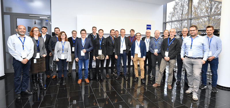
NanoWorldMaps members have signed a Memorandum of Understanding (MoU) to support the concept and implementation phase and build a preliminary governance structure.
Scientists from academia and industry will benefit from NanoWorldMaps by using open access to cutting-edge 2D/3D imaging technologies combined with pre-defined processes for sample preparation, image acquisition, and data analysis. Microscopy core facilities and centers can profit by becoming one of the distributed NanoWorldMaps nodes.
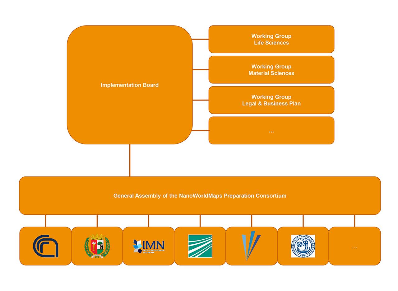
Governance structure of the NanoWorldMaps Preparation Consortium, click for full-size image
Distributed Research Infrastructure
NanoWorldMaps is in the concept phase. The concept targets the implementation of a distributed research infrastructure. NanoWorldMaps Nodes will operate the high-throughput multimodal imaging instrumentation and will offer the different Access and Service options. The overall operations are managed by the NanoWorldMaps Hub. NanoWorldMaps welcomes new members on different levels, e.g. academic users, commercial users, infrastructure nodes or industry sponsors.
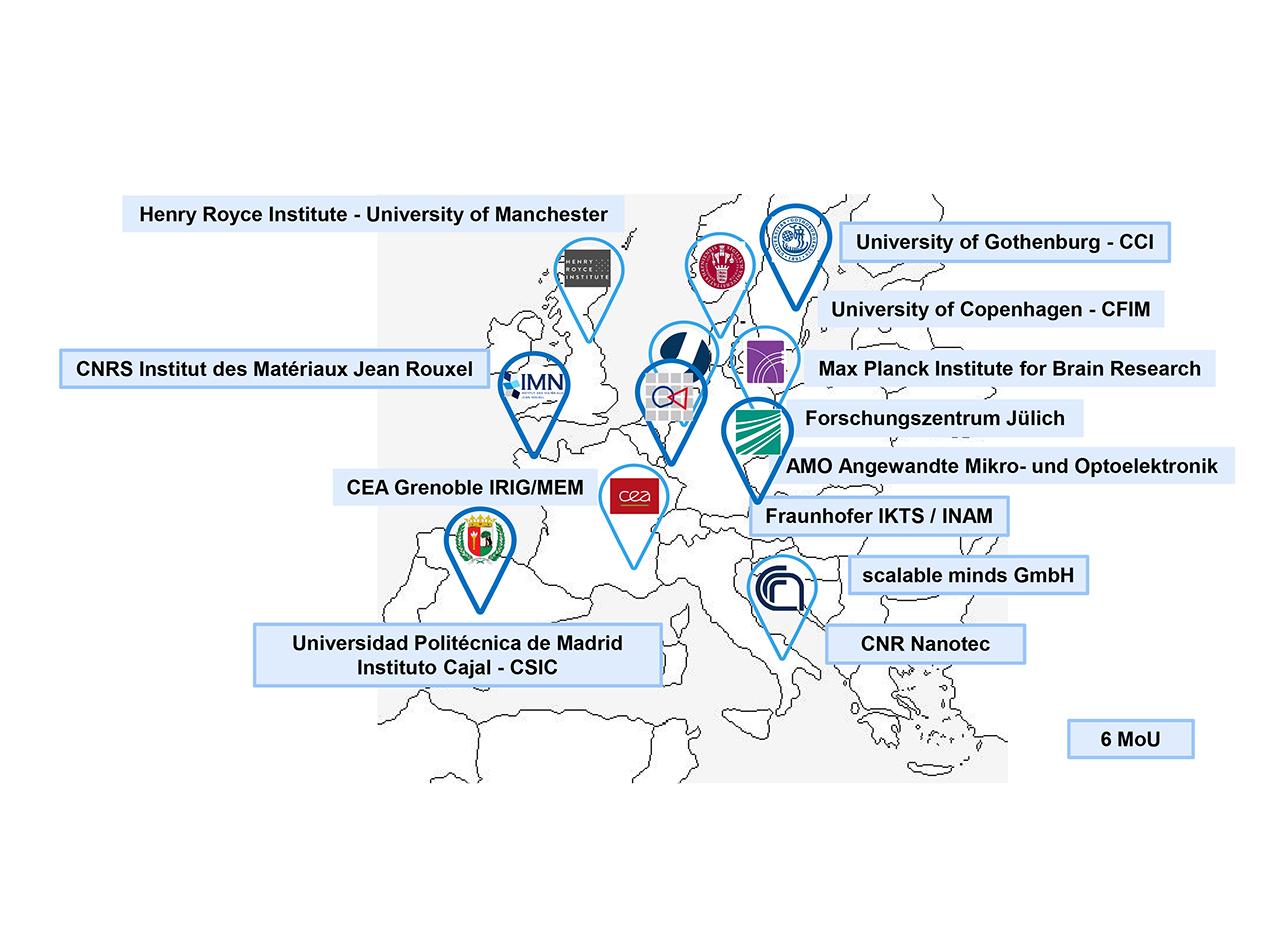
NanoWorldMaps members who have signed an MoU and interested organisations
Access and Services
NanoWorldMaps enables researchers from academia and industry to use cutting-edge Large Area 2D/3D Imaging technologies in three different formats. NanoWorldMaps is currently in the concept phase and is working on an integrated service delivery concept from sample preparation and image acquisition to data evaluation using supercomputers and Artificial Intelligence and the provision of validated data on different science cloud systems. We develop three different access and service levels.

NanoWorldMaps access and service concept